
To ease the work of PostScript and reduce the calculation times, data files europe-cil.txt etc. should be manipulated with a text editor.
All lines starting with segment ... should be replaced by :
][% segment....
For the sake of clarity, if the editor allows it, a line jump will be made between the two squared brackets ] [. It will be modified the head and the queue of the obtained file by placing in lieu of the first bracket ] :
/europe-cil [
and finally, it will be added :
] ] def.
The file will be renamed as europe-cil.dat.
This example suitable for the file europe-cil.txt should be repeated and adapted, by modifying the correspondant names to other files.
Giuseppe Matarazzo has prepared a program (included in this distribution), which performs authomatically this work. Don't have any hesitation to contact him in case of heavy troubles.
They obtain with the command :
\WorldMapThreeD[PHI=40,THETA=15,Decran=80,increment=2,%
asia=true,africa=true,namer=false,samer=false]% |
where PHI=40,THETA=15 fix, in latitude and longitude, the point of vue position: on paper the point of such geographical coordinates will be drawn at the center , while the environmental coordinates \begin{pspicture}*(-9,-4)(9,4) follow the law of a central symmetrie. Decran=80 fix the distance between the image and the plan of projection; the zoom effect will be magnified with higher values of this distance.
asia=true,africa=true,namer=false,samer=false indicates the on-off represented regions, europe=true is always on per default.
increment=2 reprsents the angular distance, in degrees, between two parallels or two meridians. How such parameters are applied will be shown on the examples below, along with other parameters.
Oxyz is the ”absolute” reference system. If RotX=0,RotY=0,RotZ=0, Oz is coincident with Poles axes, being Oxy the equatorial plan and axis Ox marking longitude 0.
The indicated values are the default ones. The image will be bigger
proportionally to distance plan-observer, while distance values are
expressed in
No obstacles appear on represent it, if the user has a quick and
memory wided computer. Otherwise, it's better to unactivate
rivers and coasts tracks.
By choising the values of PHI and THETA the point of vue is fixed.
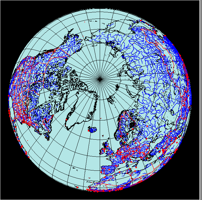
With the following scenario the observer is over the North Pole.
Parameters are as follows :
Earth globe is rotated of -45o around Ox, in the reference system Oxyz new coordinates are re-computed
.
One of the most interesting package features is to draw a globe region.
To do that, just put on false some regions, as described in
the initial sample.
Plenty of things remain to do ... for example cities names (as options),
meridians and parallels degrees and so on.
So, if you are interested to complete and upgrade these
packages pst-map2d, pst-map3d, pst-map2dII, pst-map3dII,
please don't hesitate to contact one of us.
3.2 Options
4 Usage
4.1 The whole World Map
\WorldMapThreeD[PHI=80,THETA=-10,Decran=25,city=true,%
asia=true,africa=true,namer=true,samer=true,%
rivers=false,borders=false]%
 \WorldMapThreeD[PHI=35,THETA=20,Decran=25,RotX=-45,city=true,%
asia=true,africa=true,namer=true,samer=true,%
rivers=false,borders=false]%

4.2 How show an area of Earth Globe
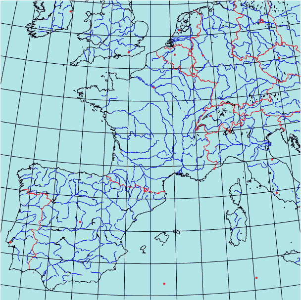
4.2.1 France
\begin{pspicture}*(-8,-8)(8,8)
\WorldMapThreeD[PHI=45,THETA=2,Decran=150,city=true,%
asia=false,africa=false,samer=false,europe=true,increment=2]% France
\end{pspicture}
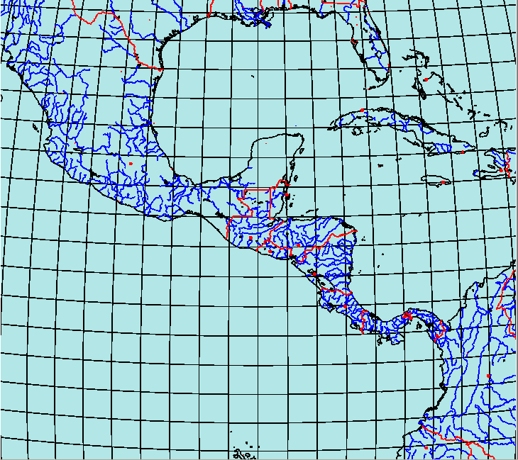
4.2.2 Central America
\hbox{\hspace{-1.5cm}%
\begin{pspicture}*(-8,-8)(8,8)
\WorldMapThreeD[PHI=15,THETA=-90,Decran=80,city=true,%
asia=false,africa=false,samer=true,europe=false,
namer=true,increment=2]% Mexico
\end{pspicture}}
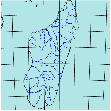
4.2.3 Madagascar
\begin{pspicture}*(-5,-5)(5,5)
\WorldMapThreeD[PHI=-19,THETA=47.5,Decran=85,Dobs=15,city=true,%
asia=false,africa=true,samer=false,europe=false,%
namer=false,increment=2]% Madagascar
\end{pspicture}
5 Files download
6 Call to cooperation